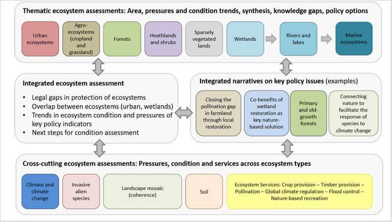
MAES emerged as a harmonization tool in the approach to ecosystems and the evaluation of the services provided by them, among Member States, whose efforts were—and are—at different stages of development and based on distinct reference systems.
This unified conceptual framework is based on the initial MA (2005) and TEEB classification, but at the same time, it is part of the component and compliant with the guidelines set by the EU Strategy for Biodiversity for 2020, which “aims to inform policy decision-makers and the implementation of policies in numerous domains that depend on ecosystems and their services. Some European countries have started TEEB studies on countries and might rely on them when fulfilling their obligations regarding Action 5, others may choose to extend mapping and valuation of value more.” Associated with fulfilling the Strategy objectives, MAES critically analyzes updated information to provide a clear picture to policymakers regarding policies both concerning specific ecosystems (aquatic, terrestrial, agricultural) and concerning territorial development.
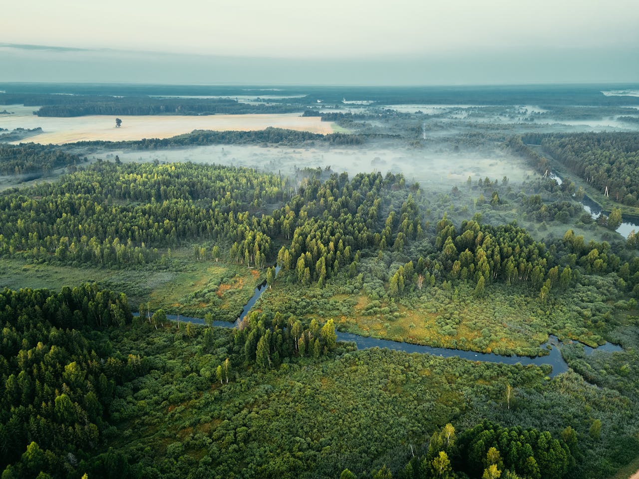
The key novelty is the mapping, promoting the utility of maps in “the explicit spatial prioritization and identification of problems, especially concerning the synergies and compromises between different ecosystem services and between ecosystem services and biodiversity,” and “as a communication tool to initiate discussions with stakeholders, to visualize the locations where valuable ecosystem services are produced or used, and to explain the relevance of ecosystem services to the public in their territory.”
MAES compiles a series of extremely useful applications, such as a European atlas of ecosystems and their services, along with case studies, which can constitute a basis for the hypothesis of the current study in which built infrastructure in a given location can acquire “ecosystematizing” characteristics that make it cancel negative effects on the ecosystem that it alters with its presence, and the effects of its presence in the medium and long term.
The atlas is updated and completed as new studies deepen, analyze, and detail habitats, ecosystems, and services, with the perspective of being developed according to the planning for 2020.
The lack of information for a given location can be supplemented where similar ecosystems, both as biotopes and in terms of biome, present similar data, so that there is the possibility of replicating the mapping in similar points across the continent.
Another application linked to MAES is the Ecosystem Services Partnership’s Visualization Tool. The online platform offers the possibility of sharing data, maps, mapping methods, etc. Case studies from Member States complete the MAES database, along with indicators and specific disciplinary references for evaluation, such as Corine Land Cover classes, the Eionet projects regarding natural capital accounting, or satellite data from Copernicus, the EU Urban Atlas—the descriptions of which are not less important for the finality of this academic endeavor.
Although MAES activities focus specifically on biodiversity and its utility to the fields of biology and geography, the necessary information can be extracted for the theory that the provision of ecosystem services can be “borrowed” by built infrastructure, a theory that can be based on the EUNIS habitat classification, Category I – Domestic habitats and J – Artificial habitats.